
Nictau Camps to Park Lodge Route
Video
Store

Quick Facts
| Features | mountains, islands |
| Access | easy |
| Route Difficulty | easy |
| Water Body Type | large lake |
| Current Type | none |
| Route Type | loop |
| Route Distance | 10 km return |
| Portage Distance | none |
| Estimated Time | 7 hours |
| Elevation Change | none |
| Scenery Rating | must see |
| Cell Reception | none |
| Fees | Mount Carleton Park |
Description
I have been interested in this route for many years due to its proximity to Mount Sagamook and the heart shaped island. I have sat on the rocky outcrops on Mount Sagamook and planned the route below. I was ever more interested after one of the park staff mentioned how great the swimming was around Visitors Island.

We stayed at the Ash Cabin the night before and it had rained hard. It was supposed to rain all weekend but it was going to be warm. We planned on going swimming anyways so were going to be wet regardless. The weather cleared off and it ended up being a very hot day between 33°C and 36°.
We started in the narrow, shallow channel in front of the camps. We then turned right to go and explore the heart-shaped island. We saw a few bald eagles fly from the island as we approached. When we got behind the island we explored the dead tree stumps and yellow lilies in a marshy area. We also got to watch a family of mergansers swimming along shore.
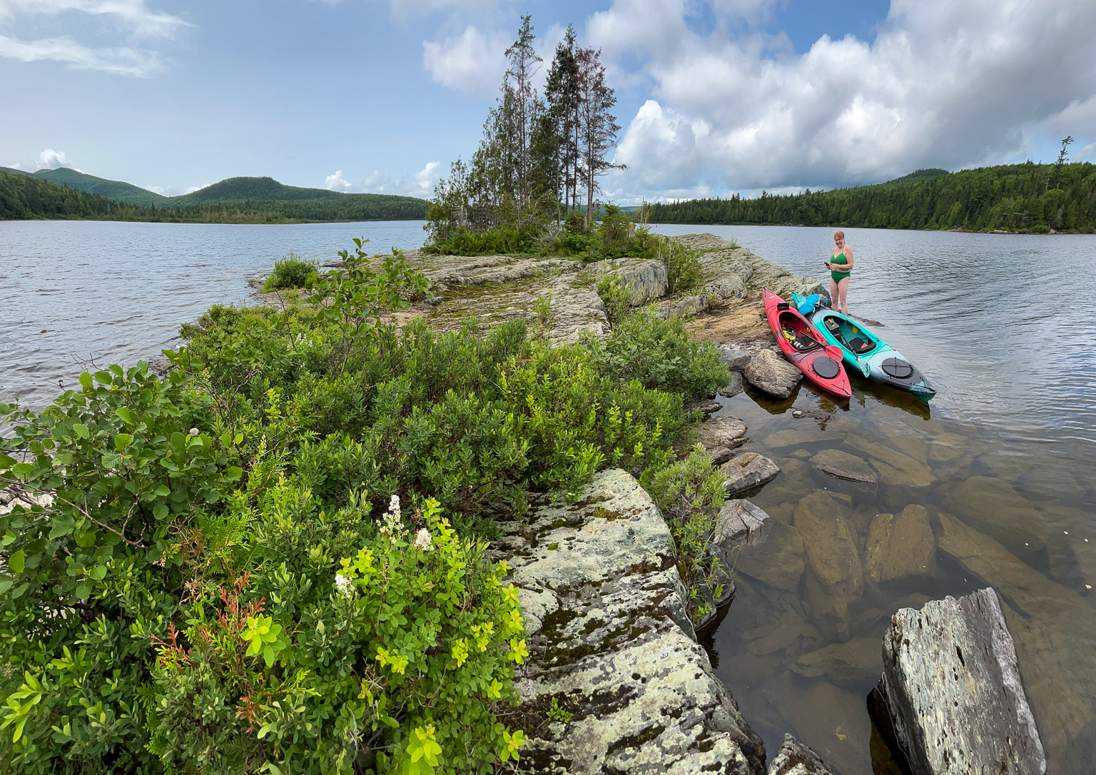
When we came back around the island we could see the rocky outcrops on Mount Sagamook poking out of the clouds. We continued on towards Visitors Island and stopped to take pictures of several eagles in the trees. When we got to Visitors Island we were fascinated by the angled rock of the island. It made a small cliff on one side that looked perfect to jump off into the water. We parked the boats and then explored the small island. We could look up at Mount Sagamook on one side, and a couple of bald eagles in a pine tree on the other side. We had to be careful of the slippery goose poop that covered the island. After jumping off the cliff a few times to cool down, we continued on our way.
We passed by the Armstrong Brook Campground and beach. The beach was empty since it was a Monday. We had the lake to ourselves. We continued on to the lodge. When we got to the lodge we cooked lunch on a picnic table by the beach. It was very hot so we went up to the lodge and got ice cream to help us cool down. After spending some time at the lodge and cooling off in the shade, we decided that we should head back. We got back in the boats and turned left to go check out the old abutments where the lake flows into Tobique River.
On our way back we stayed right. We passed by a picnic table at a point at the Franklin Campground. While passing by the campground we heard people camping. After passing the point we headed directly for the wetland under Mount Sagamook. The wind was in our favor so we took our time and just floated. Before we got to the wetland we came to a narrow gravel bar just below the surface. There were patches of yellow lilies here so I got out on the gravel bar to get a picture.
After taking pictures of yellow lilies and Mount Sagamook, we continued along the shore. The camps were in site now. We passed a few more eagles in the trees and passed by Visitors Island. It was still hot but it was getting late. We decided that we didn't have enough time for another swim if we wanted to go for a drive to check out Bathurst Lake before sunset.

As we pulled into the cabins we talked a bit with a woman that was floating around on a Stand-Up Paddleboard. She was staying in the Pine Cabin right next to the boat launch. We agreed that it was a beautiful evening in a beautiful location. After packing up the boats we went for a drive to Bathurst Lake to plan tomorrow's adventure. You can find more information on our next day's adventure on the Camp Lake to Teneriffe Lake Route page.
Map
Gallery
Directions
For directions to the park go to the Mount Carleton Park page.
From the gate, drive for 2.5 kilometers until you come to a small field and the sign for the new lodge. Drive through the small field (s-turn) and continue along the lake. Drive for another 4.9 kilometres. Just past the parking for the Mount Sagamook hiking trail, you will come to a road that descends the hill on the left. This short road takes you down to the Nictau Lake camps. Park near the camps and cross the small field to get to the boat launch.


Other Routes in the Park
- Nictau Camps to Portage Trail
- Camp Lake to Teneriffe Lake
- Bathurst Lake
- Camp Lake to Moose Bogen
Route last paddled: July 17, 2023.
Page last updated: November 26, 2023.